MOBIS-COVID19/01
Results as of 06/04/2020
A Project of IVT, ETH Zürich and WWZ, Universität Basel
Contact: Joseph Molloy (joseph.molloy@ivt.baug.ethz.ch)
On March 16, 2020, 3700 participants who completed the MOBIS study between September 2019 and Janurary 2020 were invited to reinstall the GPS Logger and Travel Diary App ‘Catch-my-Day’ to record their mobility behaviour during the period of special measures implemented to control the spread of the Corona Virus. The first 4 weeks of mobility data from the original MOBIS Study is taken for each participant as a baseline against which to compare current mobility patterns. These 4 weeks start place anywhere between 1st September and 15th November, depending on the participant. Only trips in Switzerland are currently considered, although data on cross border travel is available.
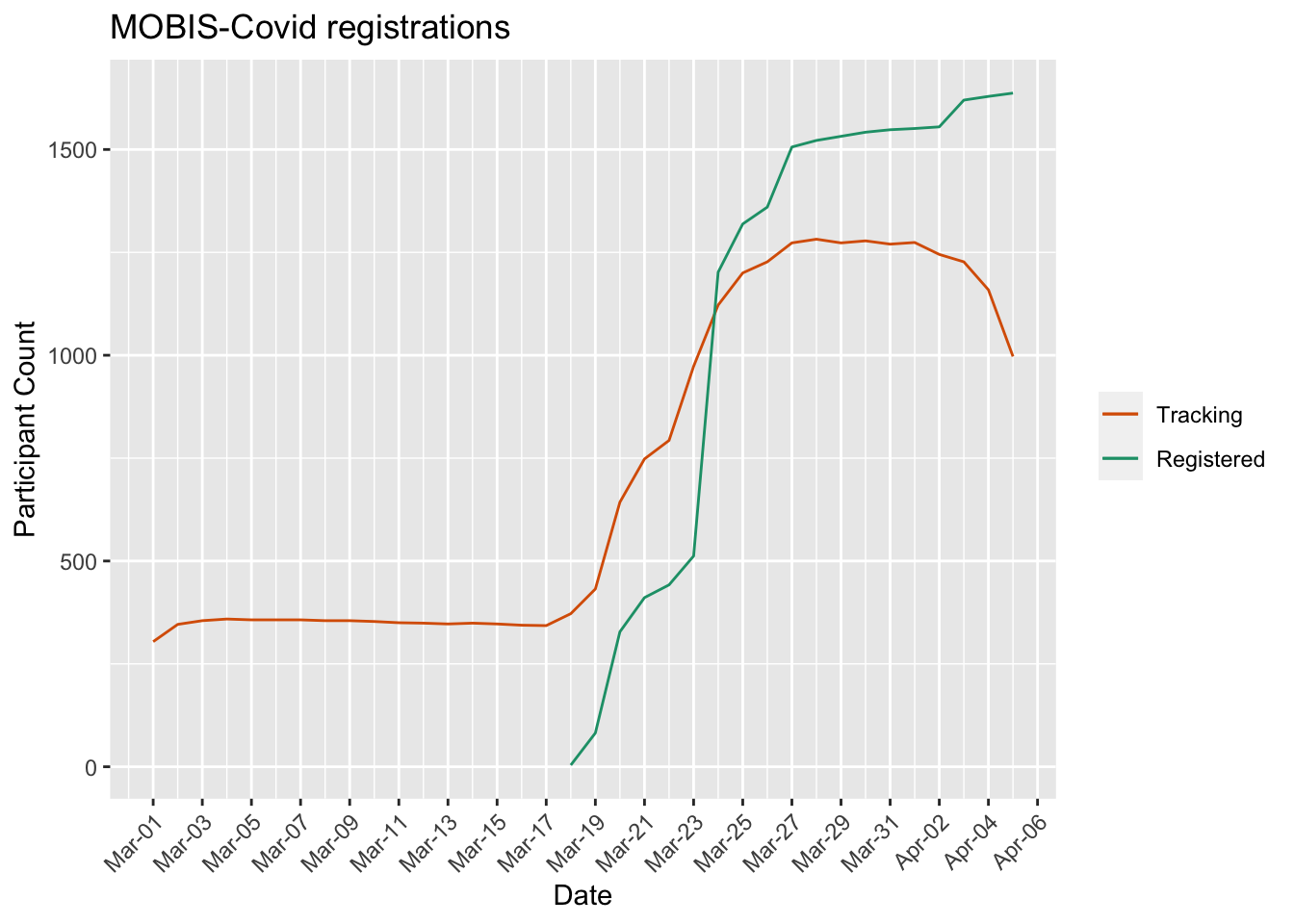
The following figure shows the number of registered and tracking participants per day. A running panel of around 250 participants were already tracking before the sample was reinvited. This allows results for the weeks before the MOBIS-Covid study was officially started, although the sample size is a lot smaller, and hence the results.
The daily values are normalized where necessary by the number of tracking participants per day. The analysis will be extended in the coming weeks to accomodate participants who record no GPS activity but are participating in the study - This will be necessary if a total lockdown is implemented.
The GPS Travel diary used, Catch-my-Day (for iOS and Android) can have a 2-3 day delay before the tracks are available for analysis. The scaling by active participants accomodates for this, but the results of previous reports may change when the report is updated.
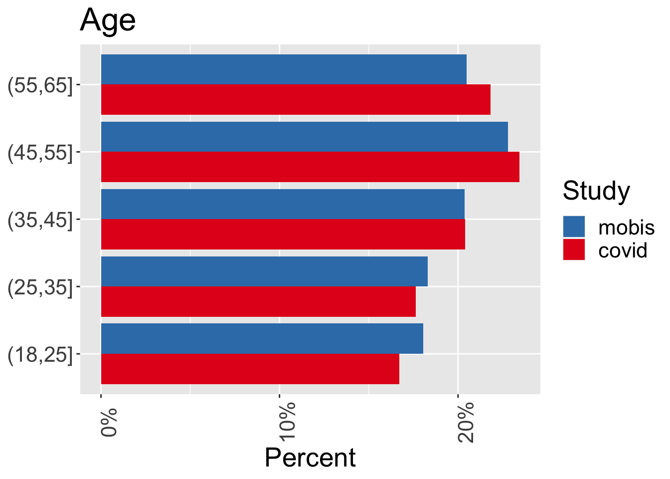
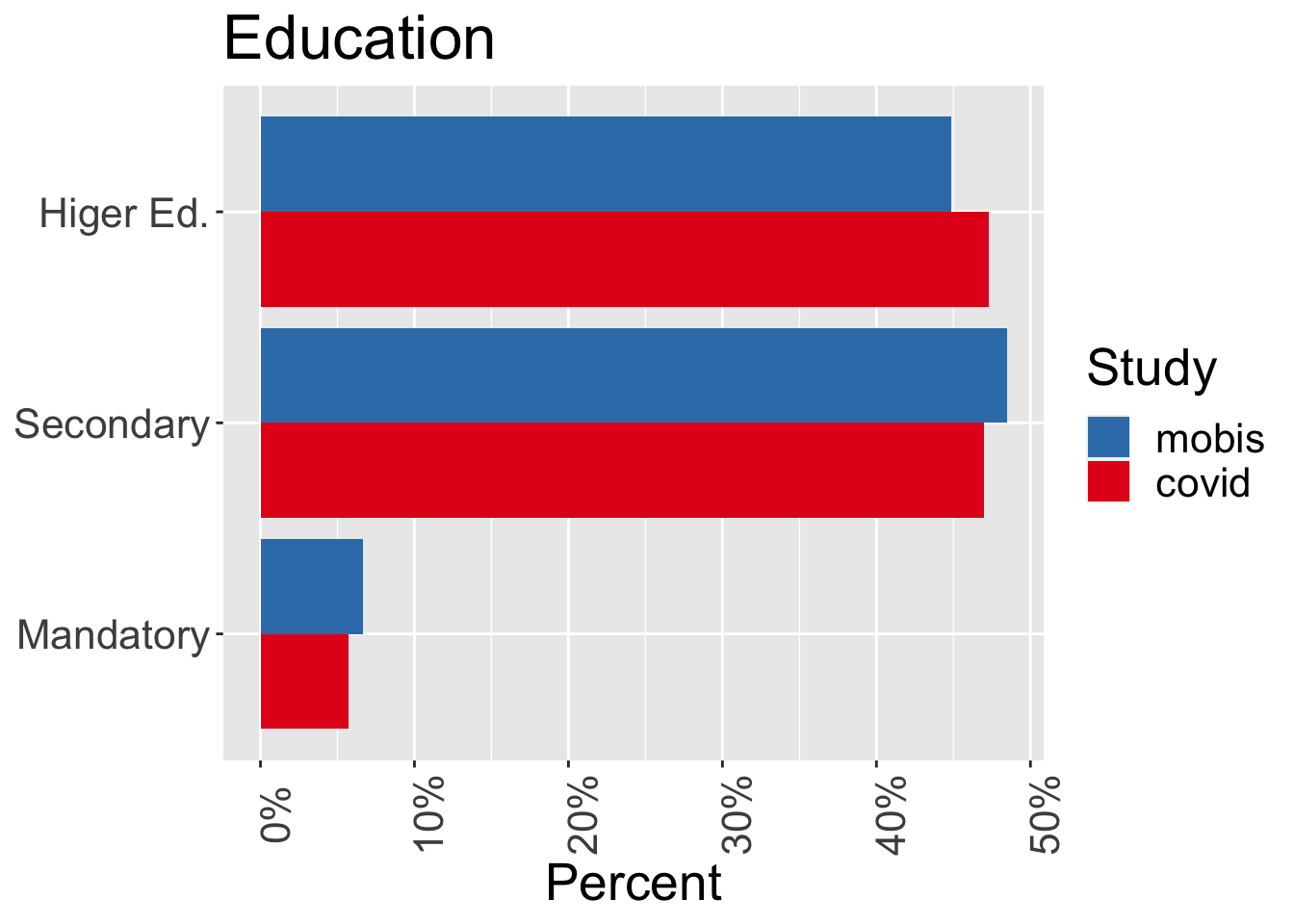
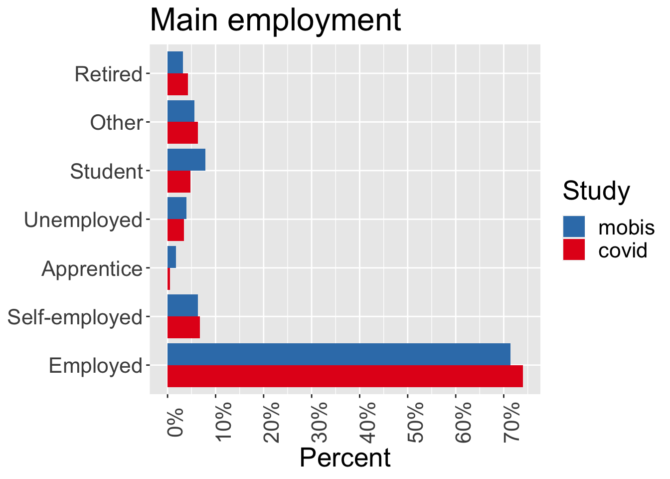
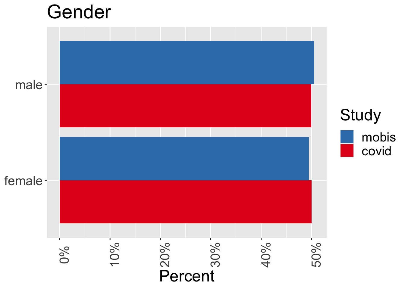
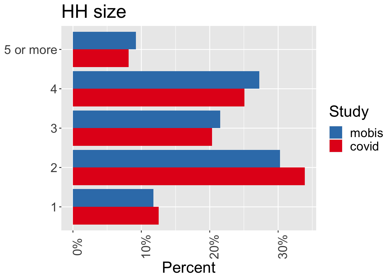
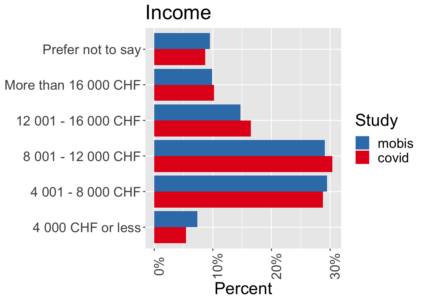
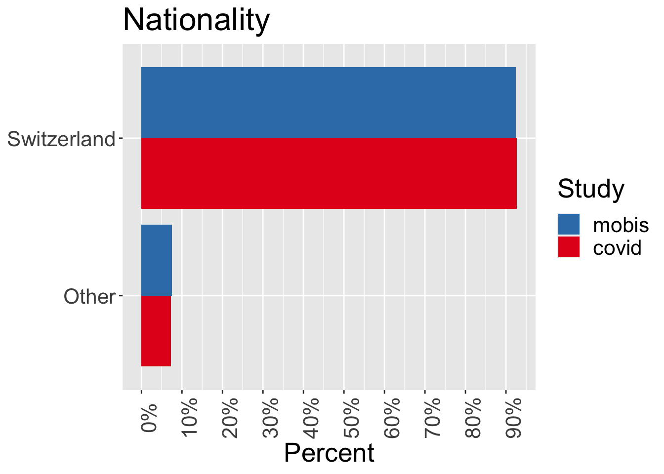
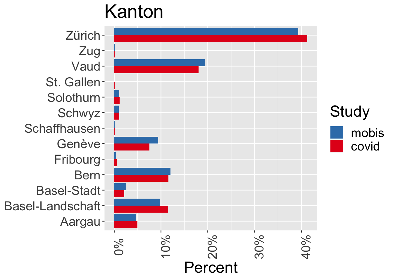
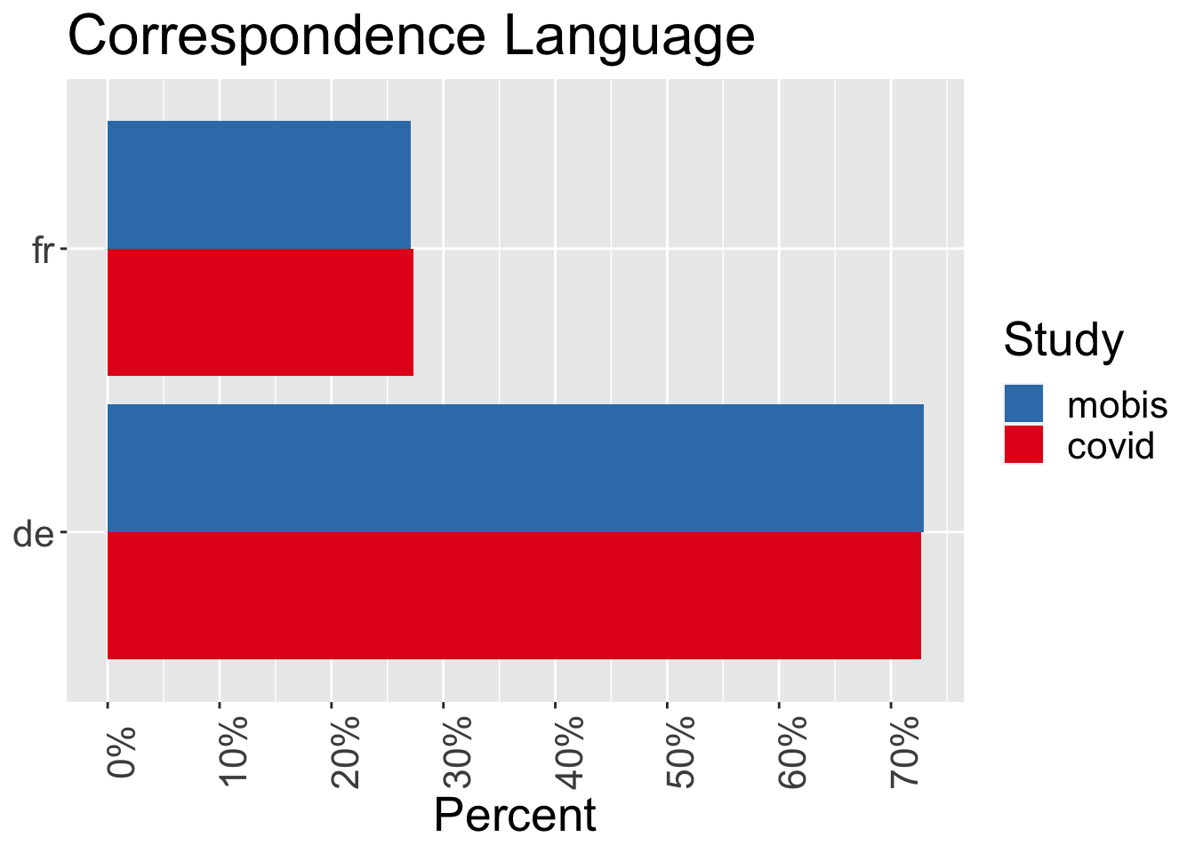
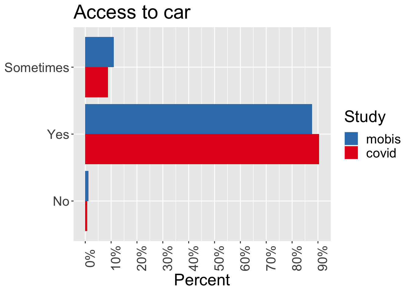
Differences in the distributions
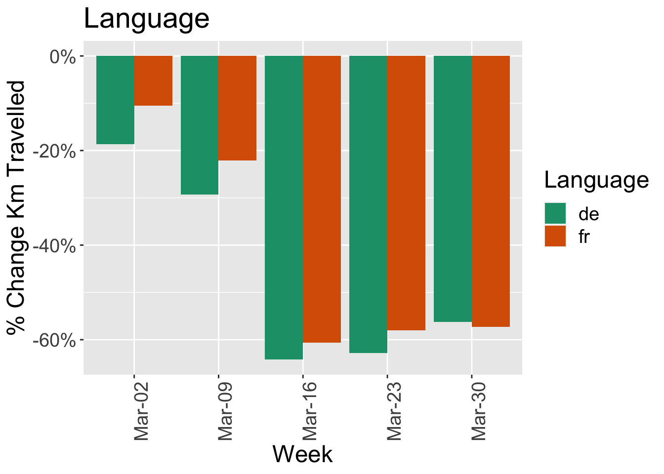
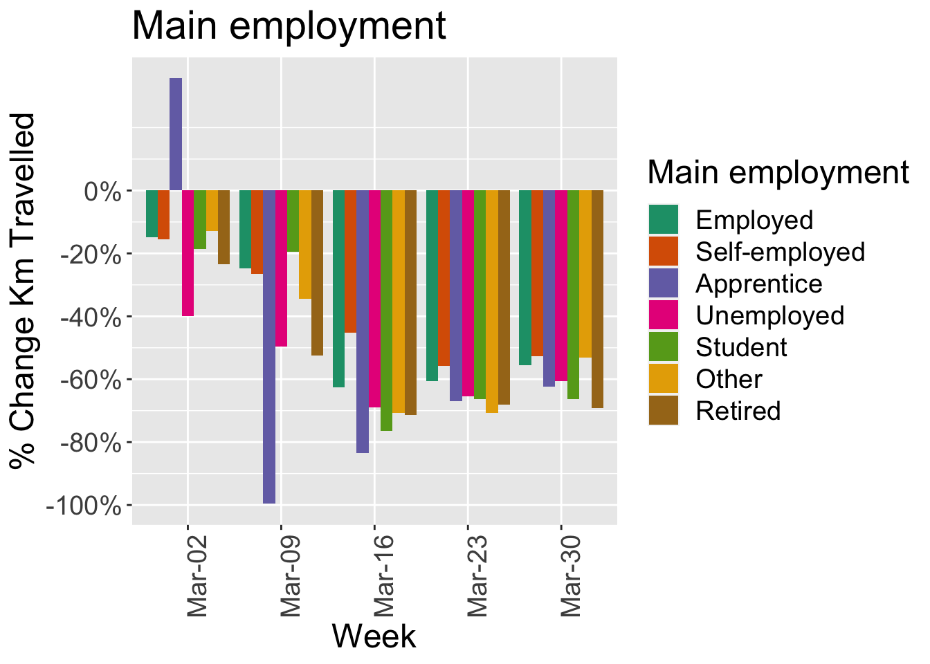
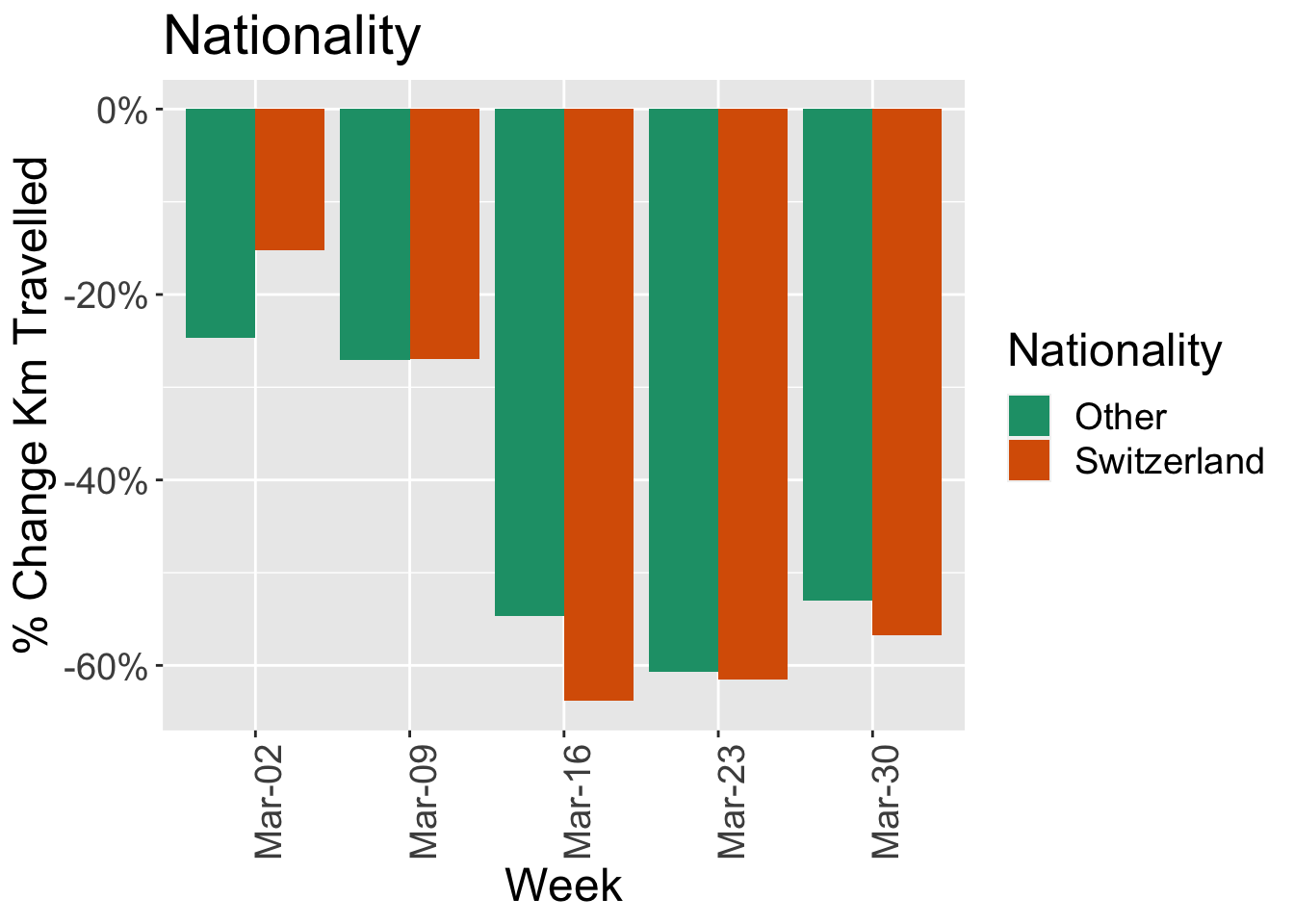
The following charts show the characteristics of the MOBIS-Covid sample compared to the original MOBIS Sample. There are some small differences, but generally the samples are consistent. This chart will be extended to compare to the relevant census data.
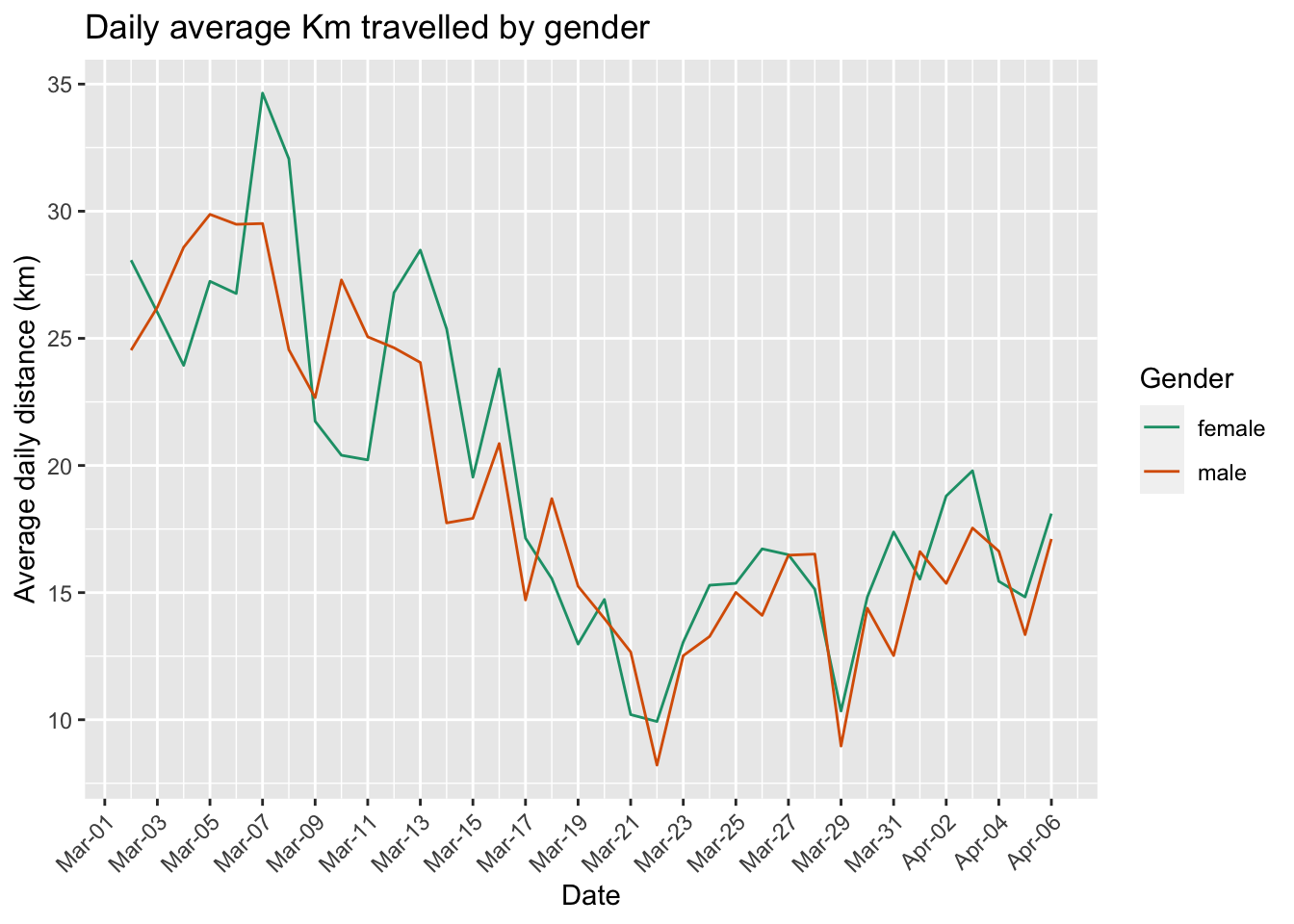
Average Daily Distance
Overall change in kilometers travelled by transport mode
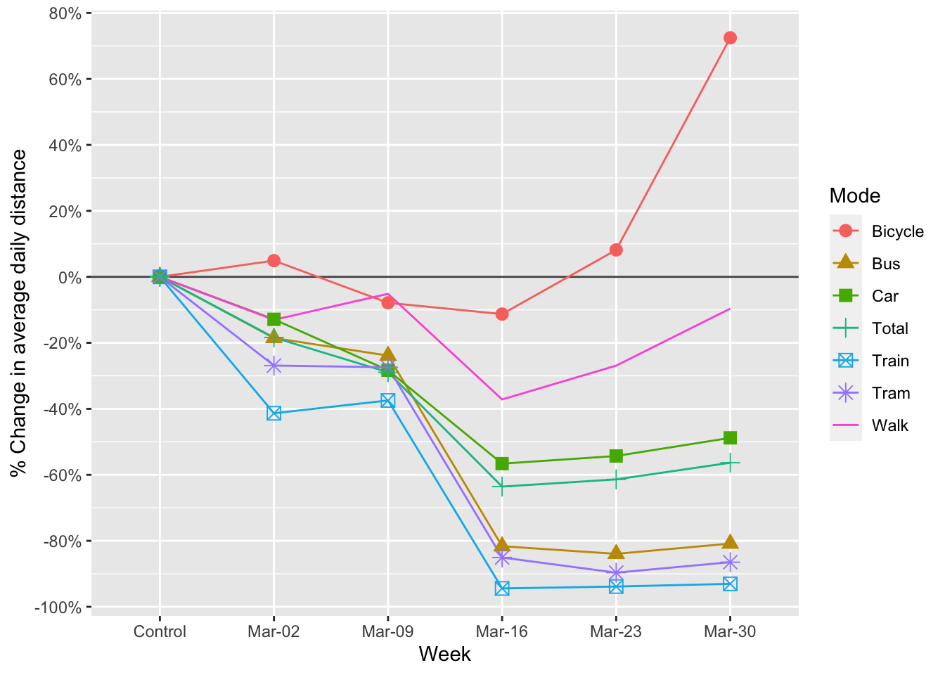
Normalized against the baseline period
Reduction in kilometers travelled by Canton
| Kanton | n | Control | Mar-02 | Mar-09 | Mar-16 | Mar-23 | Mar-30 |
|---|---|---|---|---|---|---|---|
| Aargau | 65 | 0 | -0.26 | -0.42 | -0.72 | -0.59 | -0.49 |
| Basel-Landschaft | 157 | 0 | -0.14 | -0.09 | -0.61 | -0.61 | -0.56 |
| Basel-Stadt | 29 | 0 | -0.14 | -0.36 | -0.71 | -0.74 | -0.62 |
| Bern | 155 | 0 | -0.29 | -0.31 | -0.66 | -0.59 | -0.54 |
| Fribourg | 7 | 0 | -0.61 | -0.24 | -0.63 | -0.56 | -0.61 |
| Genève | 100 | 0 | 0.05 | -0.47 | -0.69 | -0.60 | -0.55 |
| Schwyz | 14 | 0 | -0.08 | 0.12 | -0.41 | -0.65 | -0.38 |
| Solothurn | 16 | 0 | -0.14 | -0.42 | -0.62 | -0.66 | -0.51 |
| Vaud | 236 | 0 | -0.08 | -0.22 | -0.65 | -0.70 | -0.65 |
| Zürich | 564 | 0 | -0.16 | -0.25 | -0.60 | -0.58 | -0.55 |
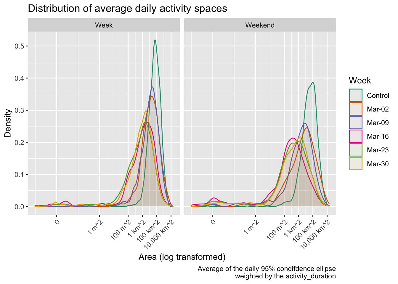
Activity space and daily travel radius
A commonly used simple definition of the activity space is the 95% confidence ellipse of the activity locations, in this case weighted by duration. In the following analysis, the activities at the home location are included, for those that had the app activated on that day. This is an important metric which gives an idea of the area in which travel is being performed. The daily travel radius is also presented.
| Week | Weekday | # Activities/day | % Change | Area (km2) | % Change | Daily Radius (km) | % Change |
|---|---|---|---|---|---|---|---|
| Control | week | 7.00 |
|
193 |
|
13 |
|
| weekend | 6.19 |
|
261 |
|
14 |
|
|
| Mar-02 | week | 6.12 | -13% | 173 | -11% | 11 | -14% |
| weekend | 5.65 | -9% | 181 | -31% | 11 | -19% | |
| Mar-09 | week | 6.39 | -9% | 120 | -38% | 10 | -20% |
| weekend | 5.47 | -12% | 92 | -65% | 9 | -36% | |
| Mar-16 | week | 4.82 | -31% | 36 | -81% | 6 | -55% |
| weekend | 3.56 | -42% | 28 | -89% | 4 | -73% | |
| Mar-23 | week | 4.39 | -37% | 38 | -80% | 5 | -61% |
| weekend | 3.95 | -36% | 58 | -78% | 5 | -64% | |
| Mar-30 | week | 4.76 | -32% | 48 | -75% | 5 | -58% |
| weekend | 4.25 | -31% | 37 | -86% | 5 | -63% |
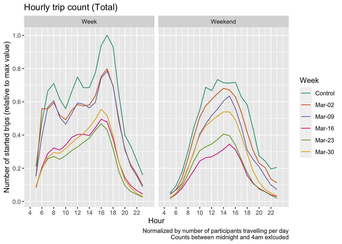
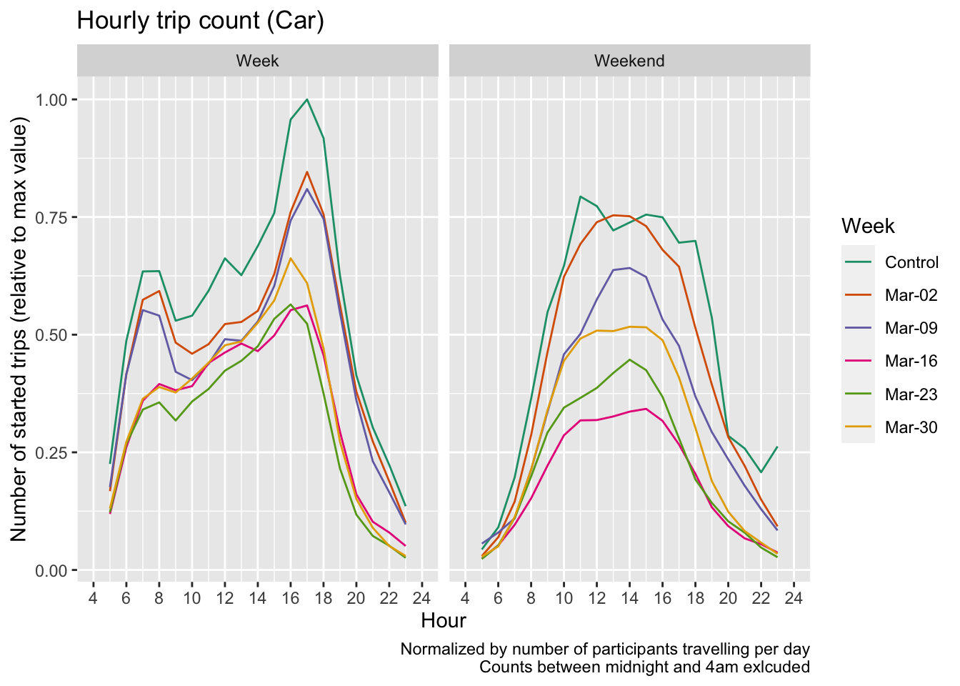
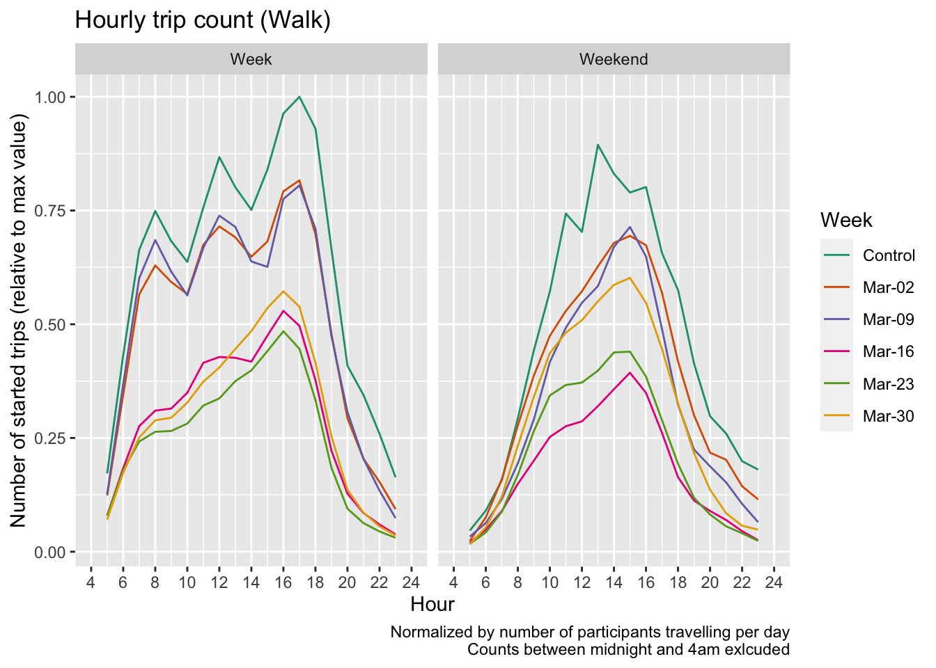
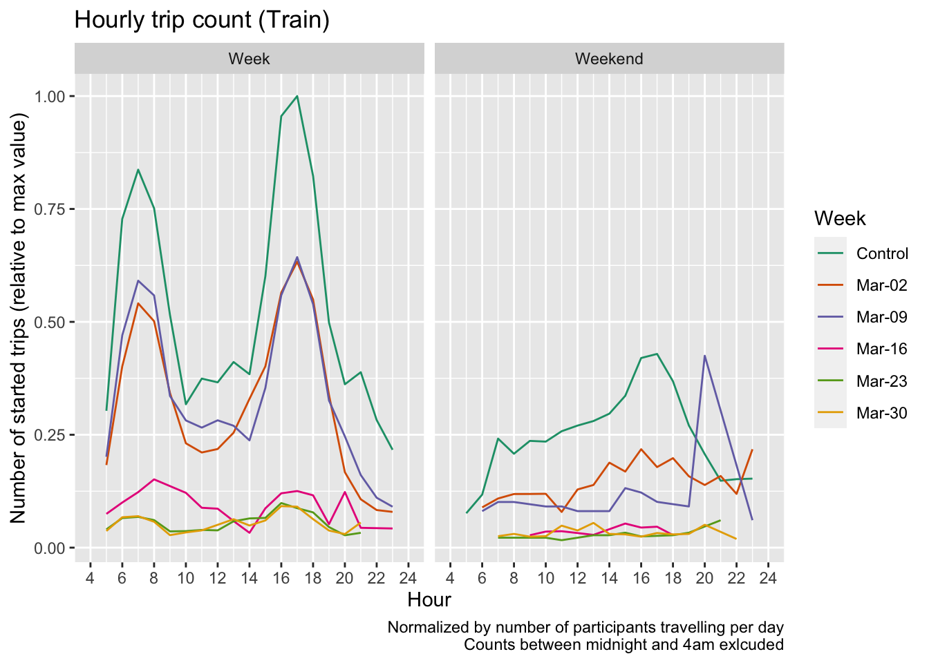
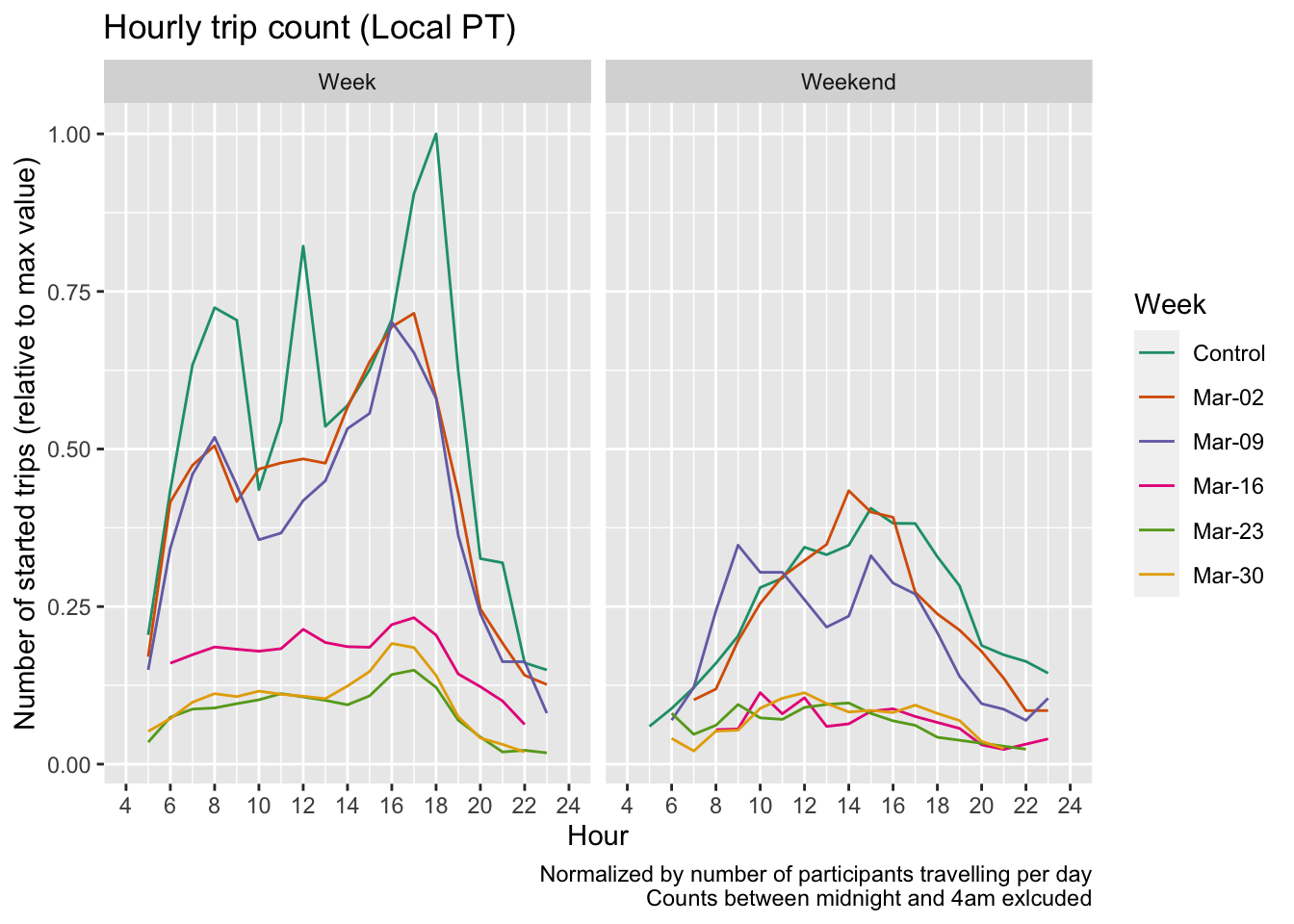
Hourly Counts
The number of trips started per hour, smoothed with a rolling average over 3 hours. The y axis is normalized by the maximum hourly value in the graph.